| VISIT FLORIDA Completes First 200 Miles of Google Maps Project |
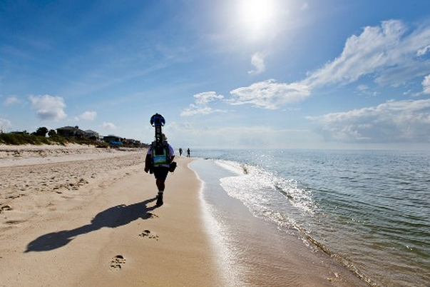
 In July, a team of trekkers from VISIT FLORIDA began an odyssey to capture stunning images of the Sunshine State’s 825 miles of beaches using Google’s Street View Trekker technology. On Friday, the two-person team completed the Northwest Florida leg of the journey, which began on the Gulf Islands National Seashore and ended on the western tip of the St. Joe Peninsula and Crooked Island.
During this time, the team captured over 150,000 panoramic images of Florida’s beaches, spanning 200 miles – or half a million footsteps! These 360-degree images will be integrated into Google Maps, enabling potential visitors from around the globe to experience interactive views of Florida’s world-renowned beaches before they ever leave home.
 Today, the same team shifts to Northeast Florida near Fort Clinch State Park and begins moving down the coast. A second team will take over in a few weeks, reaching Jupiter near mid-September. In October, the team will capture the beaches from Cedar Key to Boca Grande, finishing by covering South Florida and the Keys in November.
The images will be available on Google Maps in early 2014, but you can keep up with the Trekkers now by visiting our online Photo Journal.

Kevin McGeever
Senior Editor
Category: Uncategorized | Tags: Google Maps, Google Street View, VISIT FLORIDA | Comment »
Leave a Reply